
 Check the
documentation
Check the
documentation Ask the
Community
Ask the
Community Take a look
at
Academy
Take a look
at
Academy Cognite
Status
Page
Cognite
Status
Page Contact
Cognite Support
Contact
Cognite Support

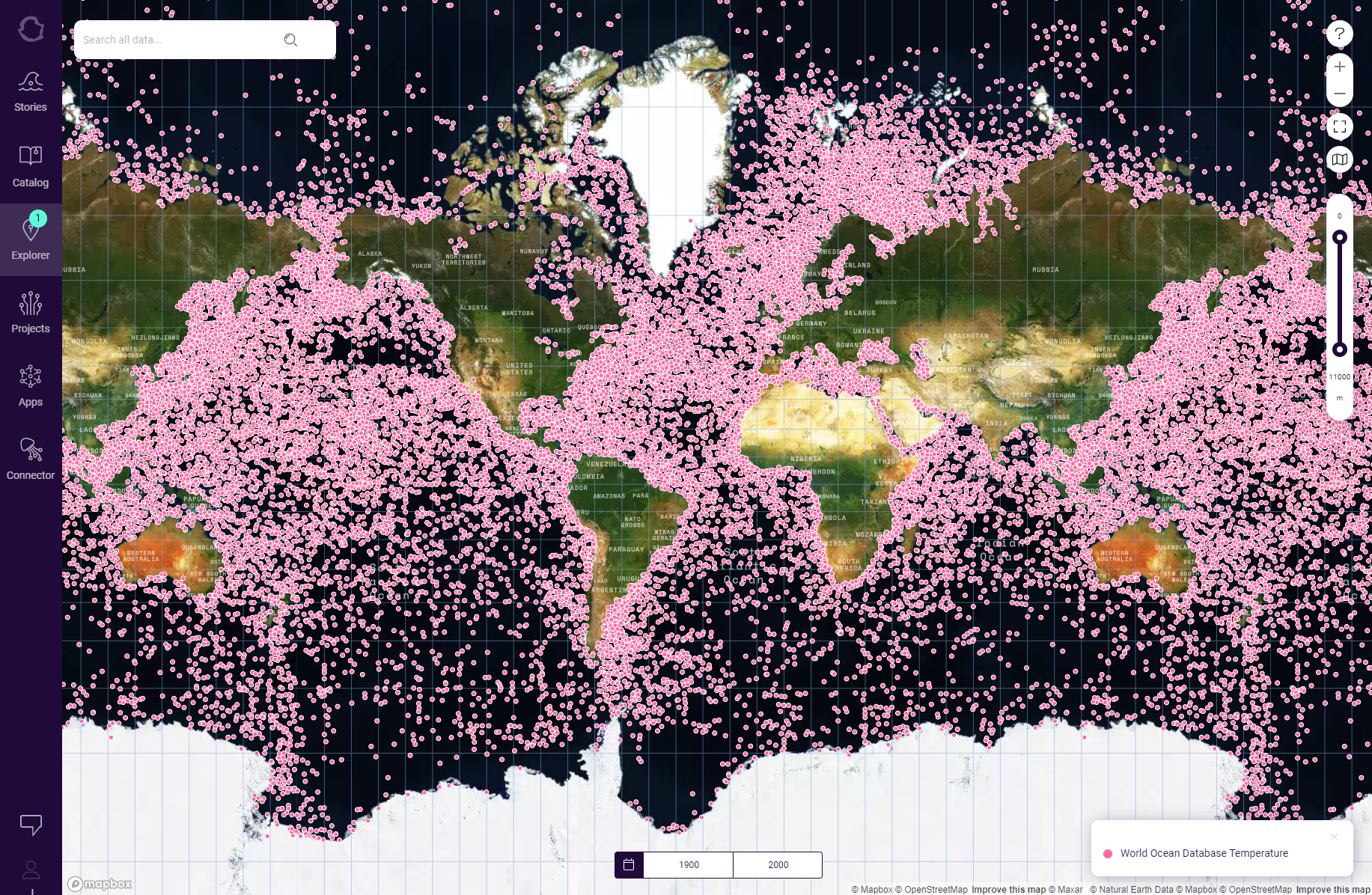
This is how it looks like when you push geospatial to the limit and show 4+ billion essential ocean variables (temperature, salinity, pH, oxygen etc) captured from 220,000 research cruises from 1890-YTD. Such data is very important to understand the effects of climate change, for instance ocean warming, deacidification, dead-zones (lack of oxygen), biodiversity migration and more. In the Ocean Data Platform, we have implemented something called the “Ocean Data Connector” which is a cloud-based JupyterHub infrastructure where you can analyze this data in a very efficient way.